
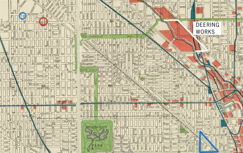
Circles indicate the Rostkowski home on Avers (blue) and the nearest Catholic church, St. Hyacinth (red). The “Polish triangle,” the center of the Polish community, is indicated in blue.
Map of Chicago 1904. Circles indicate the Rostkowski home on Avers (blue) and the nearest Catholic church, St. Hyacinth (red). The “Polish triangle,” the center of the Polish community, is indicated in blue.
